 | By Joseph Henry WHEN people think of going on vacation in Thailand, sandy beaches, spa treatments and great food usually come to mind. For runners, being able to run and explore new surroundings is a special treat come holiday time, but what if the entire purpose of the holiday is to run? |
There is growing trend in which running is the vacation, whether for a race, a training camp or a running adventure. It is called a runcation (yes, that is an actual thing). I recently booked a training camp version of a runcation that included a three-day, 90 kilometres of trail running with ascent and descent of nearly 5,500 metres in the mountains of Chiang Mai.
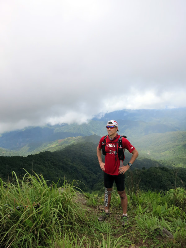
 | The area is a fertile region of mountains, valleys and rivers, and it is where the Himalayas begin to rise and includes Thailand’s highest point: Doi Inthanon (2,565 metres) and Doi Chiang Dao (2,225 metres). Dotted with tropical vegetation, pine forests and rice paddies, the mountains are inhabited by ethnic tribes hailing from Tibet, Burma, China and Laos. Each community has their own culture, language and traditions. The owner of Thailand Mountain Trail, Sebastien Bertrand, spent more than three years exploring Thailand's vast network of known and forgotten hill-tribe trails. He mapped out 350 kilometres of lost trails including a route from Chiang Mai to Chiang Rai. He also fostered relationships with villagers throughout the region and helped fund schools and local football fields. Sebastien and co-organiser Jeri Chua, the owner of Red Dot Running in Singapore, provided us with a briefing, and we met an amiable group of runners from Singapore. Striking up a conversation with a South African named Jethro, I learned he had attempted a self-sustained, 300 mile Yukon Ultra race in minus 40 degrees arctic winter. Also joining was Thai ultra-running legend Dr Jung Chumphol Krootkaew, who had just completed an astonishing 42-day ultra-trail run in Nepal! All I could say was, “I'm just a new trail runner trying to improve.” |
Day 1: Huay Nam Sai to Doi Mong Ngo and Huay Kub Kab – 1,500 metres
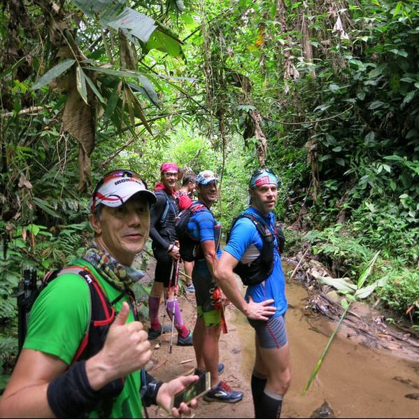
Our group hopped on a local red songtaew for the two-hour ride to the starting point at Huay Nam Sai. We tackled a dense bamboo jungle and traversed the stunning hill-tribe farmlands before reaching a high Hmong-tribe village near the peak of Doi Mong Ngo. Then a long climb to the 1,300 metre-high rest area surrounded by greenery and wooden houses nestled amongst the mountainside.
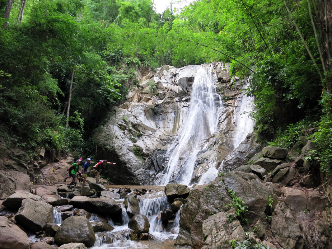
For the second part of the day, Sebastien warned us that a jungle river section would be rife with leeches, so we must never stop moving (I was the only runner to end up with a leech and a bloodied sock). After running all day, we rounded a corner to the sight of a beautiful waterfall, and like a group of kids, we enjoyed playing in the water.
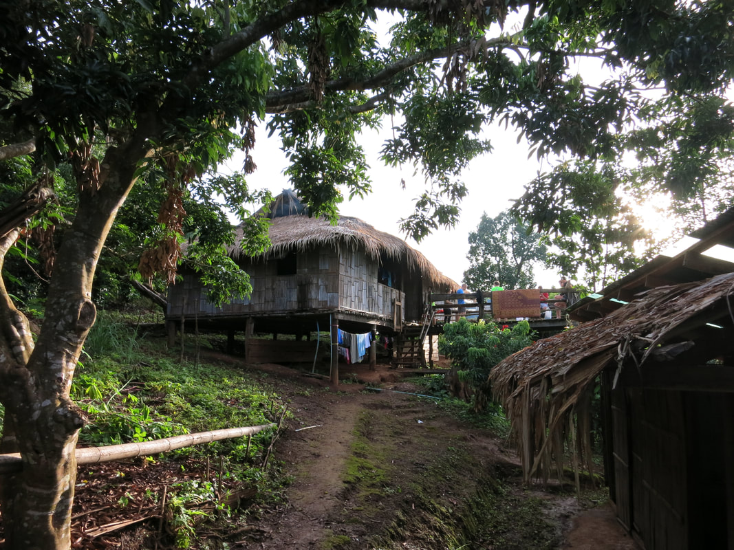
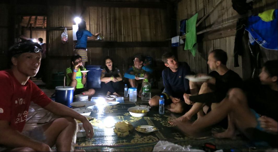
The final leg of the trip was an 800-metre climb that led us to our home for the night: a charming Lahu village called Huay Kub Kab. We ate and slept in a large communal bamboo hut. We had run over 30 kilometres.
Our group hopped on a local red songtaew for the two-hour ride to the starting point at Huay Nam Sai. We tackled a dense bamboo jungle and traversed the stunning hill-tribe farmlands before reaching a high Hmong-tribe village near the peak of Doi Mong Ngo. Then a long climb to the 1,300 metre-high rest area surrounded by greenery and wooden houses nestled amongst the mountainside.
For the second part of the day, Sebastien warned us that a jungle river section would be rife with leeches, so we must never stop moving (I was the only runner to end up with a leech and a bloodied sock). After running all day, we rounded a corner to the sight of a beautiful waterfall, and like a group of kids, we enjoyed playing in the water.
The final leg of the trip was an 800-metre climb that led us to our home for the night: a charming Lahu village called Huay Kub Kab. We ate and slept in a large communal bamboo hut. We had run over 30 kilometres.
 |  |
Day 2: Doi Pha Sam Liam, Doi Pakhia Summits and Chiang Dao - 2,200 metres
On the second day, we began a long run down winding dirt roads, and the atmosphere more alpine. I practised using my new running poles. It was awkward at first, but I got used to them quickly and just in time for some steep climbing and technical downhill sections.
We began tackling the first of two 1,600-metre summits. Reaching the top of Doi Pha Sam Liam was only possible by the narrow goat paths along steep drops, but the view alone was worth it. After a quick break, we departed on our last but long downhill trek.
Climbing the second peak (Doi Pakhia), I could not help but think about how beautiful Northern Thailand is. At the top, we ran into pine forests and passed over part of the massive mountain of Chiang Dao.
By the end of the run, we had covered 31 kilometres and over 2,200 metres of elevation. It was time to head back to Chiang Mai for a hot shower and for a good night’s sleep in a real bed.
Day 3: Doi Suthep to Doi Pui - 1,800 metres
The last run was on the highest mountain and at the doorstep of Chiang Mai. Starting from behind the Chiang Mai Zoo, we passed Wat Pah Lat monastery to start a steep trail climb up to Wat Doi Suthep, which is 900 metres above sea level. It was impressive to see how wild and beautiful the trails were just 15 minutes from the city centre. Behind the tourist-ridden temple, a hidden gem of a path took us to the top of the mountain at 1,650 metres.
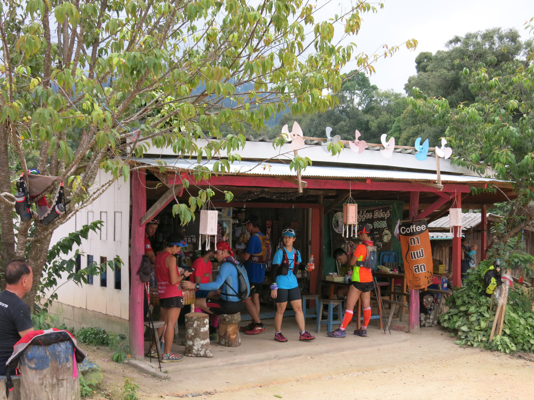
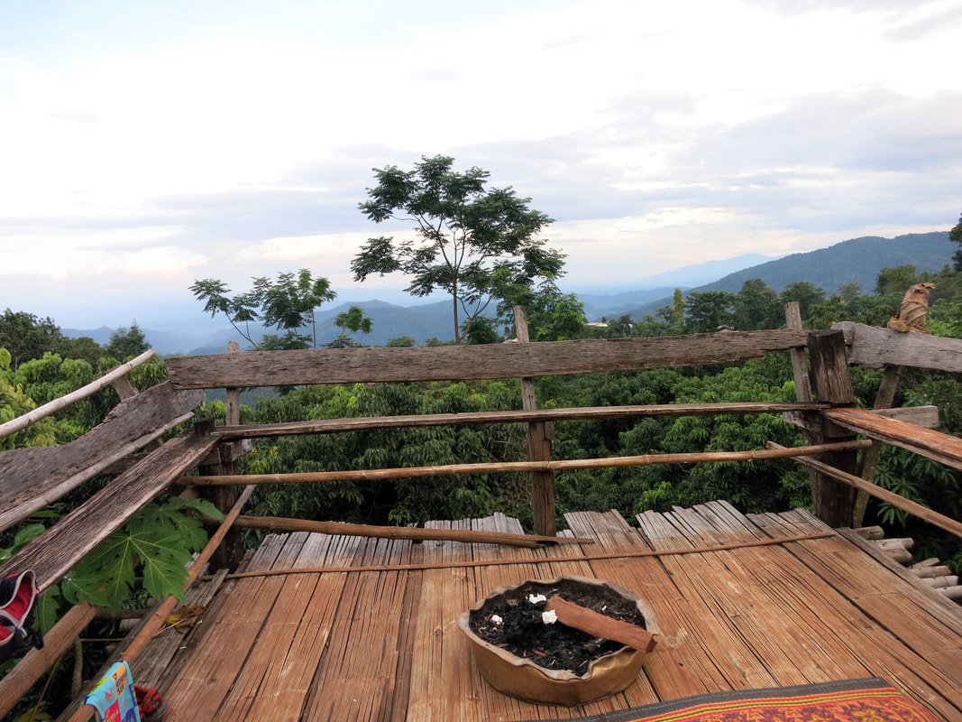
Standing at the top and eastern side of Doi Pui, the view over the valley of Chiang Mai is panoramic and imposing. On the west side, as far as we could see, it was an endless vista of green elevation. We enjoyed coffee in a Hmong village before tackling the last kilometres down the mountain to the final Hmong village and the ride back to the hotel.
The last run was on the highest mountain and at the doorstep of Chiang Mai. Starting from behind the Chiang Mai Zoo, we passed Wat Pah Lat monastery to start a steep trail climb up to Wat Doi Suthep, which is 900 metres above sea level. It was impressive to see how wild and beautiful the trails were just 15 minutes from the city centre. Behind the tourist-ridden temple, a hidden gem of a path took us to the top of the mountain at 1,650 metres.
Standing at the top and eastern side of Doi Pui, the view over the valley of Chiang Mai is panoramic and imposing. On the west side, as far as we could see, it was an endless vista of green elevation. We enjoyed coffee in a Hmong village before tackling the last kilometres down the mountain to the final Hmong village and the ride back to the hotel.
Tired but satisfied, I thought about the people I met during the trip. I flew back to Bangkok vowing that Chiang Mai had become my second home.
 RSS Feed