Pamir Mountains
By Christian Schulz
A group of hardy expats venture into a region known as the 'Roof of the World
A group of hardy expats venture into a region known as the 'Roof of the World
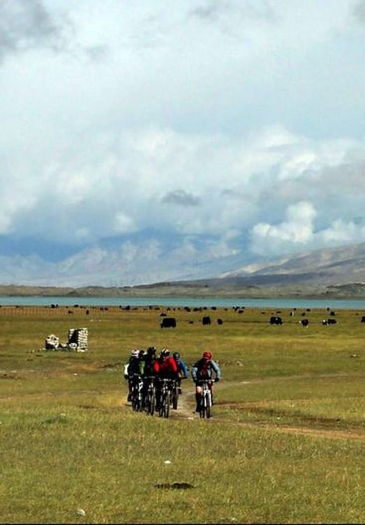 Cyclists sharing the high altitude plateau with local yaks | After making cycling trips over the last 20 years through the centre and on the eastern side of the Tibetan plateau, as well as across a number of the Himalayan slopes in Ladakh, Nepal, and Bhutan, the most Southwestern region of China (Xinjiang) appeared as a relatively unknown place worth exploring. The Pamir Mountains are a mountain range in Central Asia formed by the junction of the Himalayas with the Tian Shan, Karakoram, Kunlun, and the Hindu Kush ranges. They are among the world’s highest mountains known as the “Roof of the World” since Victorian times, presumably a translation from Persian. Xinjiang, the largest of China’s administrative regions have borders connecting eight countries - Mongolia, Russia, Kazakhstan, Kyrgyzstan, Tajikistan, Afghanistan, Pakistan, and India. Until recently, its population was mostly Uighur with a Tajik and Uzbek background where Muslim and Islam is an essential part of their lives and identity. Their language is related to Turkish, and they regard themselves as culturally and ethnically close to the Central Asian nations. The region’s economy mainly revolves around agriculture and trade, with towns like Kashgar thriving as hubs along the famous Silk Road which is rather a complex network of routes. Over the years, development has brought new residents. This so-called ‘autonomous region’ showed signs of growing Han Chinese influence. In the year 2000 census, Han Chinese made up 40 percent of the population, as well as large numbers of troops stationed in the region and unknown numbers of unregistered migrants. |
| The long journey to reach Kashgar via Urumqi was one of the easier logistical hurdles to overcome when accessing this rather off-the-beaten-track location. Obtaining a visa and permit to the remote areas required seven separate Chinese government departments to agree and approve. In addition to the detailed planning, a well-maintained mountain bike and a minimum degree of physical fitness were required to make sure one didn't lag behind becoming a burden to the group. To explore some of the original villages and the more untouched nature requires some extra effort when cycling this remote area from Kashgar heading south into the Pamir Mountains. The bumpy rides on jeep tracks or rough stony trails used by sheep, goats, yaks, and camels at altitudes close to 4700m opened a new world. The increased hard work was well compensated by the magical 360-degree view which included lakes, glaciers, far-distant orizons, and towering peaks like the majestic Mt Kongur. At high elevation, weather becomes a significant factor as it can change from one minute to the next. While wind and the sudden drop in temperature are not pleasant, getting caught in fast-gathering mist and clouds risks disorientation. Discipline in making sure the group stays together is essential as a night spent unprotected in the bare mountains in sub-zero degrees with possible snow storms is nothing to look forward to. | 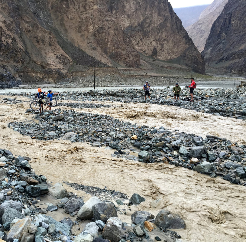 Rain in the barren valleys triggering a flash flood careful maneuvering through jeep tracks |
The nights, we spent in tents. Some felt the impact of the altitude as we continuously trudged on at 3000 to 4000m above sea level, but at least the well-insulated sleeping bags helped guard against the cold. The early morning sunrise was the best time to enjoy the scenery the sky was mostly clear, and the fresh light uniquely illuminated the surrounding peaks. After a quick breakfast, some minimum bodily hygiene routine, and a final check of the bikes, clean legs pushed the pedals on. The occasional simple four-walled hut made from natural stone and plastered with dung where herdsmen watch their goats and sheep on the slopes brought some life into this seemingly barren land. Small alpine flowers added colours to the overall rocky ground.
The first few days at higher elevation were followed by long downhills towards the lower areas, entering valleys and enjoying the apparent rise in temperature. Only the earlier specially obtained permits allowed access to these more remote but more inhabited areas. Here, regular police checkpoints required a regroup followed by a very detailed check of passports and permits by the very strict Han Chinese soldiers. No photos allowed!
The first few days at higher elevation were followed by long downhills towards the lower areas, entering valleys and enjoying the apparent rise in temperature. Only the earlier specially obtained permits allowed access to these more remote but more inhabited areas. Here, regular police checkpoints required a regroup followed by a very detailed check of passports and permits by the very strict Han Chinese soldiers. No photos allowed!
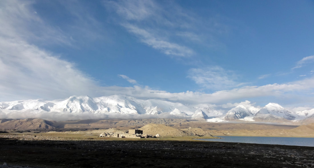
 Snowy peaks of the Pamir Mountains | 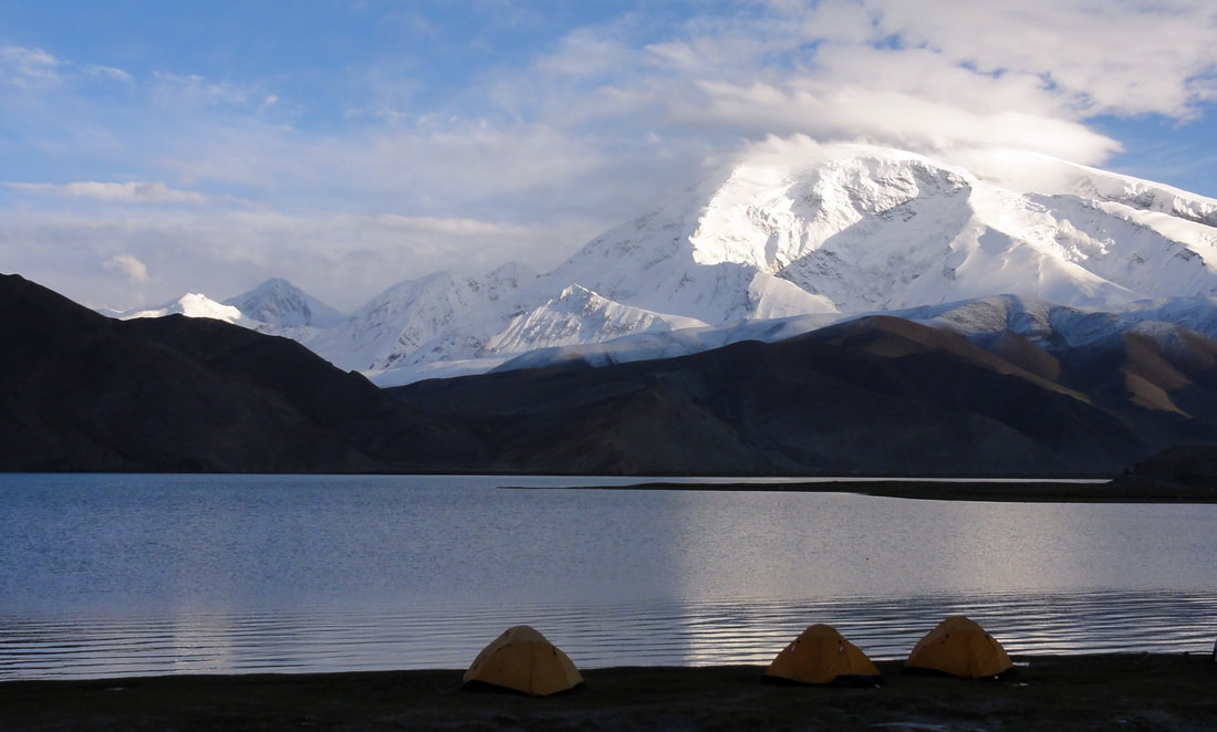 Camping overnight in tents, with views of the majestic Mt Kongur in the morning sun |
| The steep valleys were lined by tall, vertical rock walls and boasted some cold, fast-flowing rivers. The occasional village which appeared like a green oasis was inviting. The inhabitants welcomed the rare sight of some western-looking enthusiastic cyclists. The locals are very friendly, though not blessed with riches we were welcomed into their simple houses where tea and bread were served. The locals make a living by growing maize, sunflowers, walnuts, and vegetables. Here and there, a few sheep, goats, or cows provide milk and occasionally meat. Water for drinking or irrigation is obtained from nearby streams. It was surprising to note that electricity had already reached the bigger and more frequented valleys. However, donkeys are still the primary means of transport. On Day 5, we found an earlier heavy rainfall had triggered a landslide covering the dusty jeep road for a few hundred metres. Since this massive stream of boulders, rocks and mud were still in motion, it was far too dangerous to cross. Despite this being our earlier planned and permitted route, we had to find an alternative. Adjusting the course by cycling up the nearby valley and trying to set up the tents for the night in a different village caused a significant issue with the local authorities (in almost every village there is already an official of Han Chinese background ensuring Beijing’s views are followed. Although the reason was obvious, it took some long and intense negotiations, always trying to avoid any loss of face, for the official, to finally agree and grant permission to spend the night in a village “not as scheduled and approved” by the authorities. Visiting a local school, we had a very warm welcome from smiling school kids and their teacher. It was sad to note that presents like exercise books and writing utensils we had brought to donate were not welcomed by the authorities. | 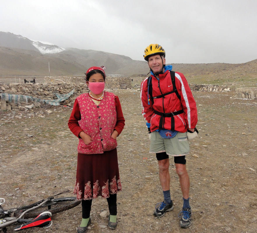 The author with a friendly local 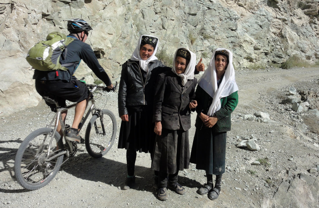 ‘Farangs’ meet the locals |
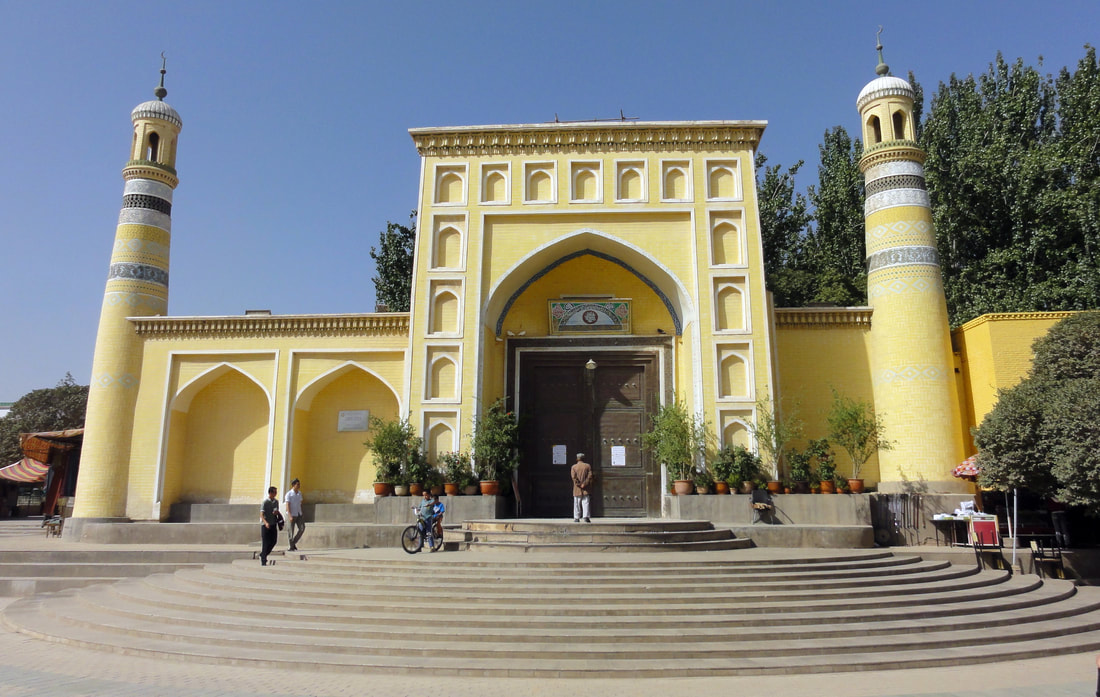 The historic Id Kha Mosque in Kashgar, dating back to 1442 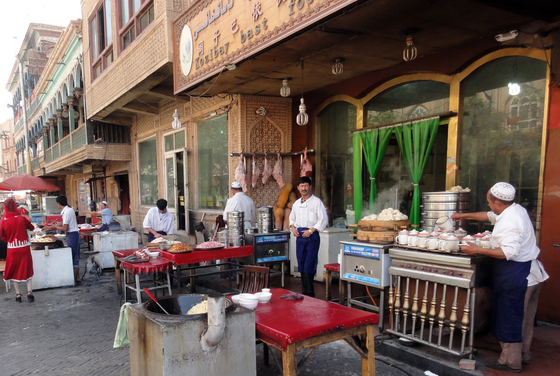 Street vendors in Kashgar – all Halal | Despite the strict control, the area is not too far from the Afghanistan and Pakistan borders and close to an area under Taliban rule, it was, in a way, a good feeling that the watchful eyes of the authorities reduced the chances of people getting kidnapped. After some further days of gentler riding through valleys of rustic beauty, moderate temperatures, friendly locals, with basic facilities, the return to Kashgar were like a transformation back to reality. This lively city, which reflected the cities in Eastern Turkey of 30 years ago, provided many modern amenities as well as heritage, like the historic Idkha Mosque, built in 1442 and traditions like the local camel market. The stay in the former Russian Consulate-turned-hotel, the variety of food, and the well-appreciated local beer completed another adventure for this group of longtime friends which dates its origin to running with the Hash House Harriers in the ’80 and ‘90s in Taipei. On to ongoing friendship and new vistas in the years to come. 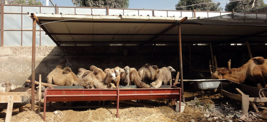 Kashgar’s camel market |
 RSS Feed